Thursday, July 15, 2010

Landslide lake in Pakistan ,Hunza

Landslide lake in Pakistan

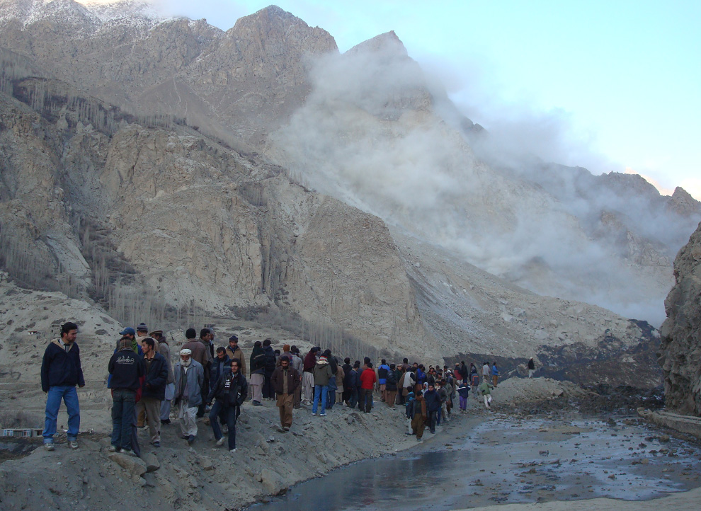
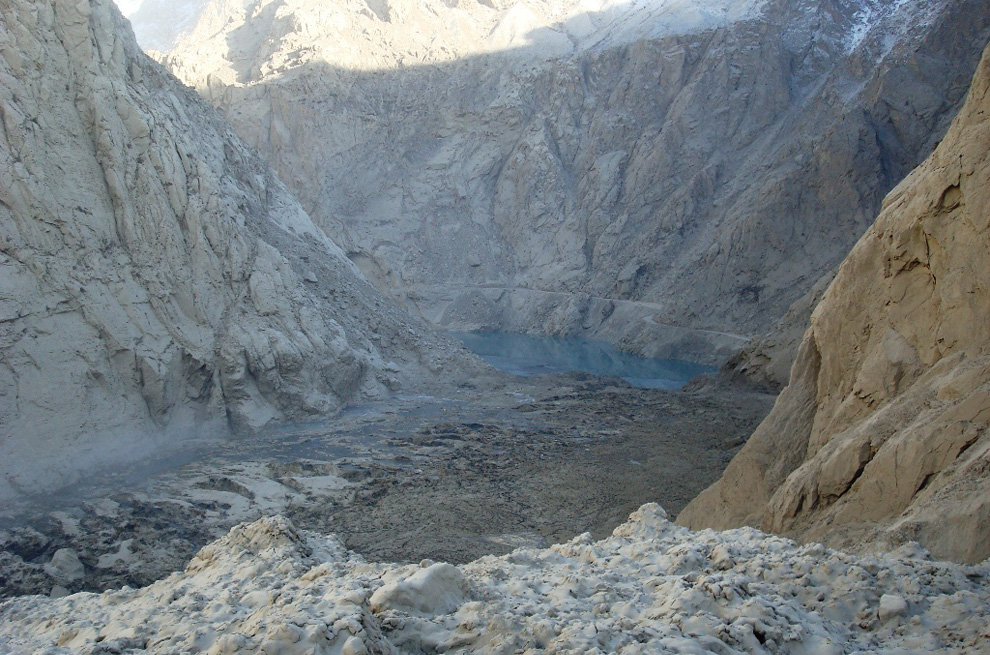
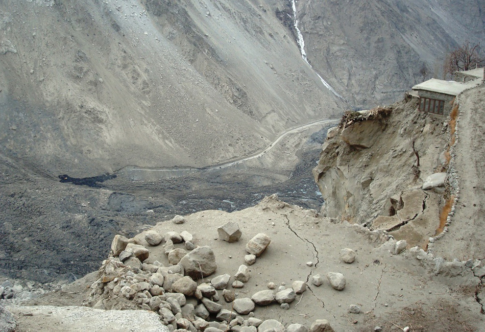
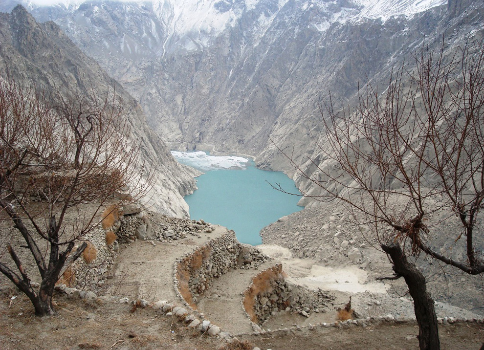
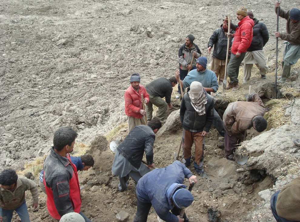
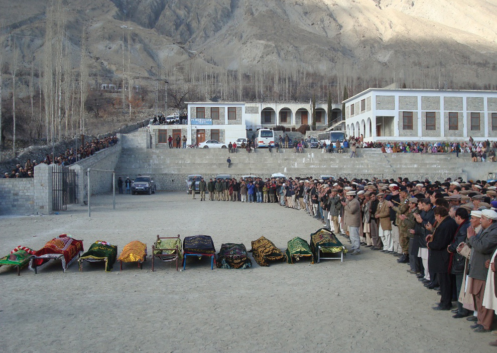
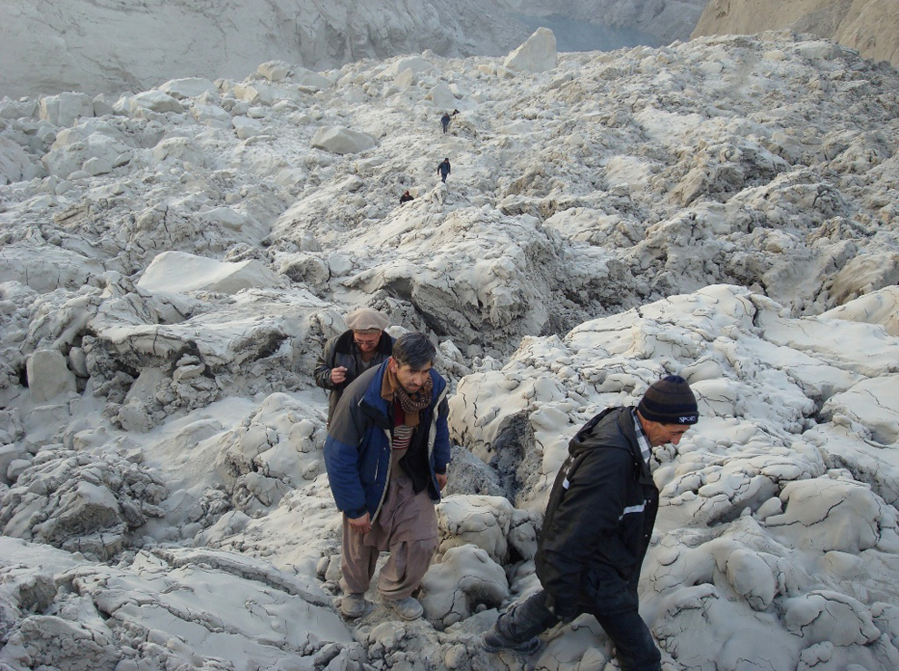
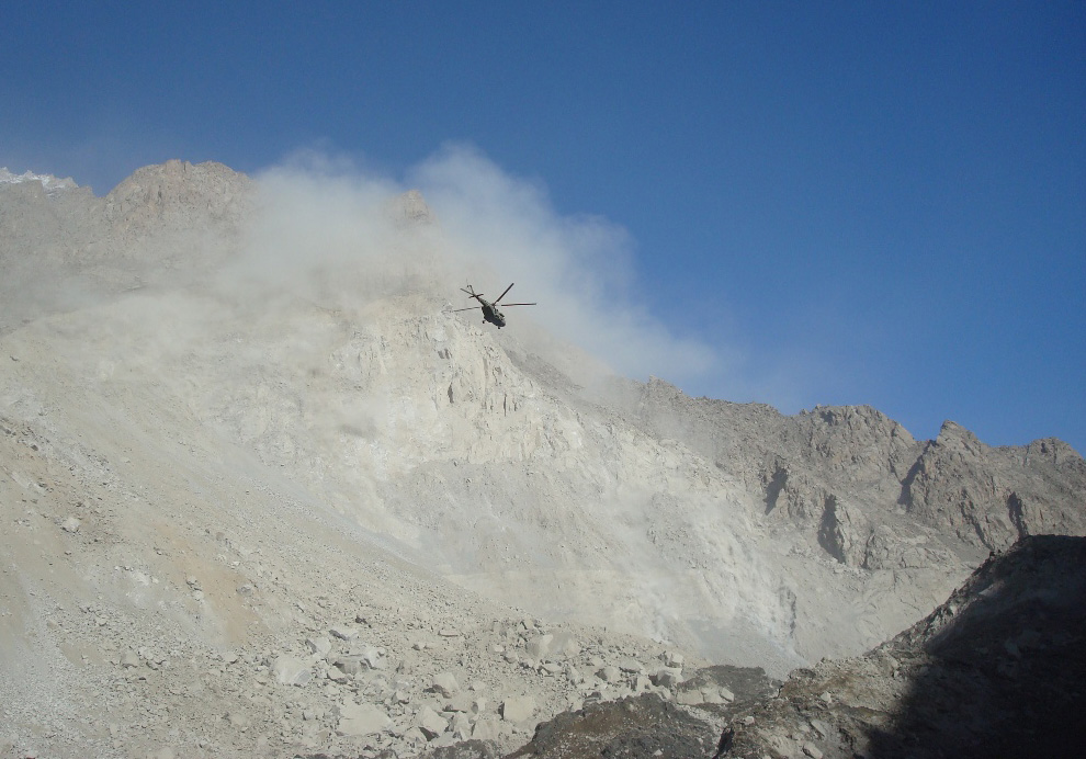
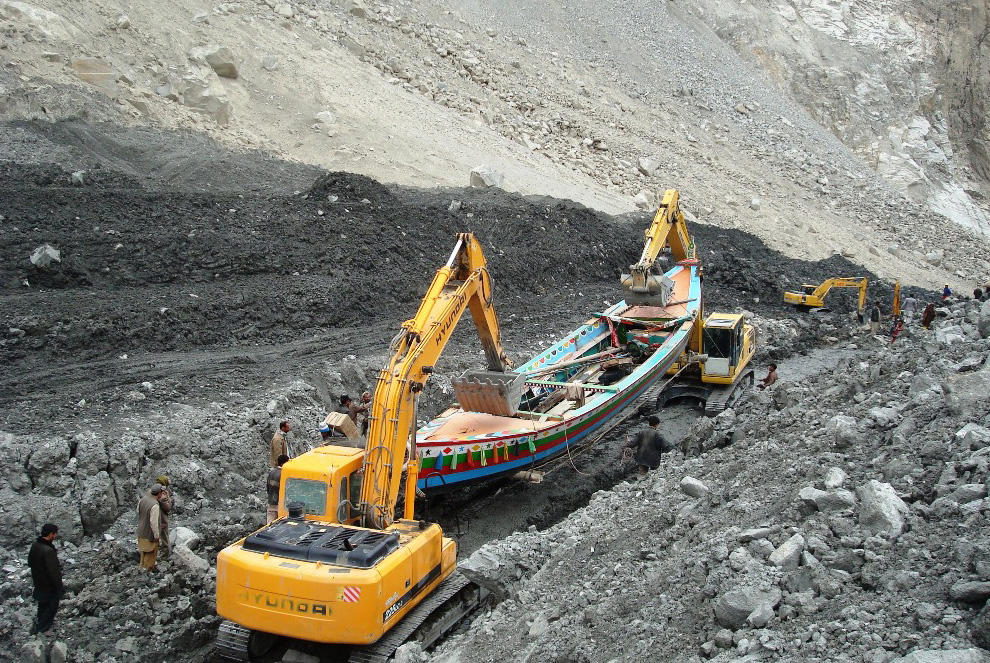
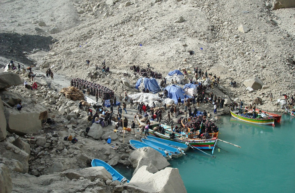
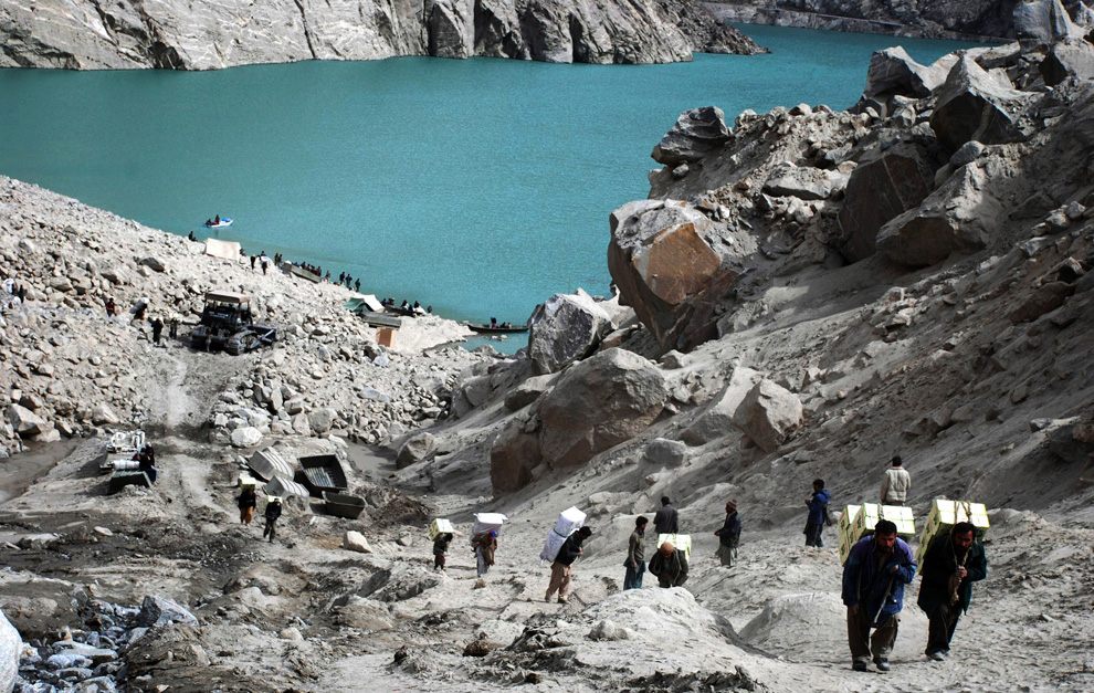
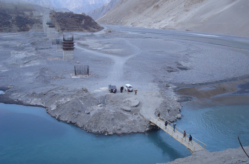
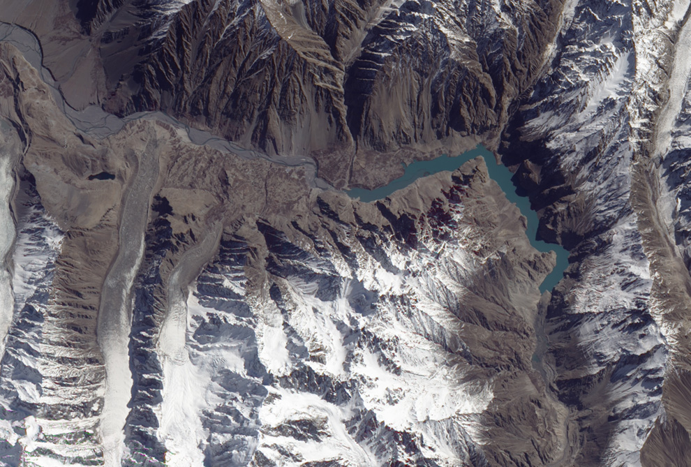
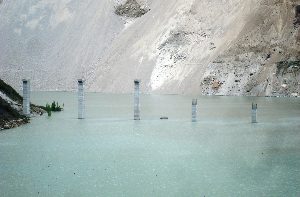
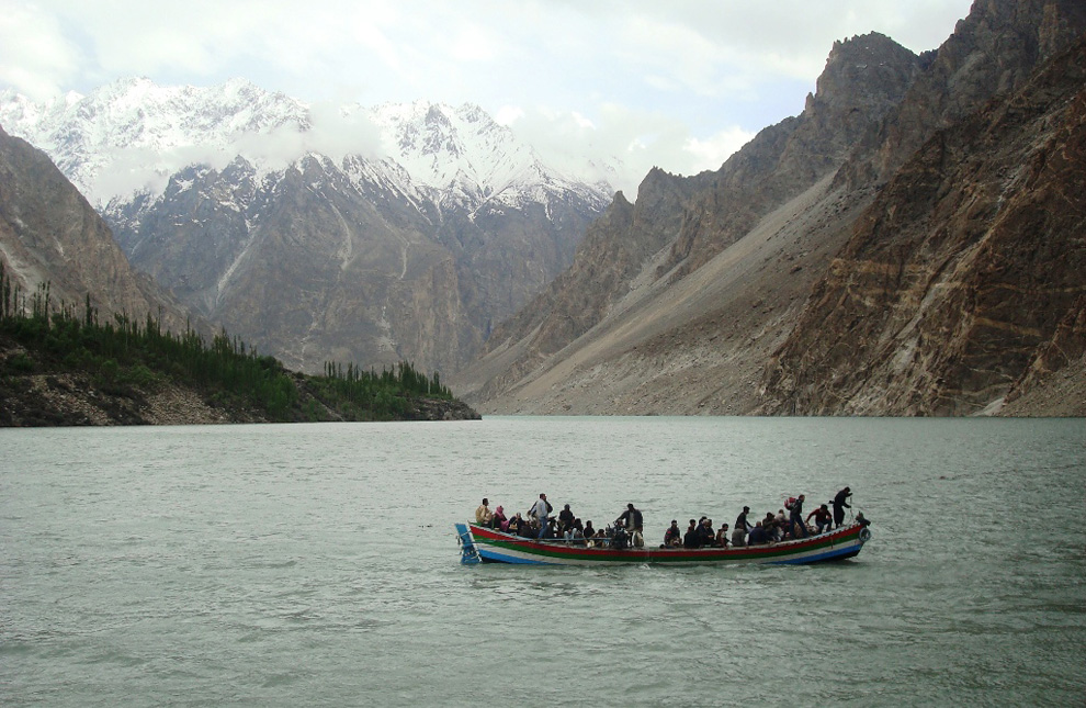
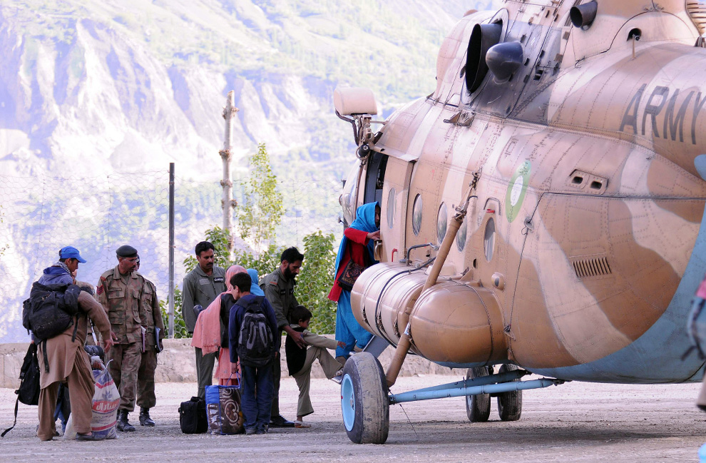
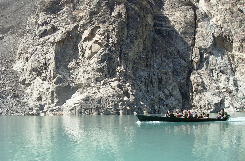
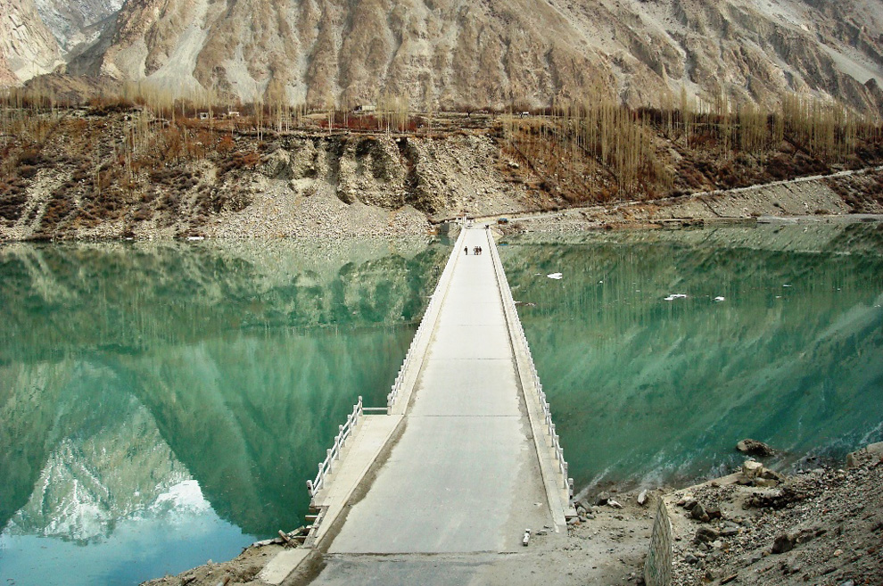
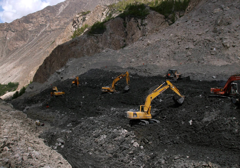
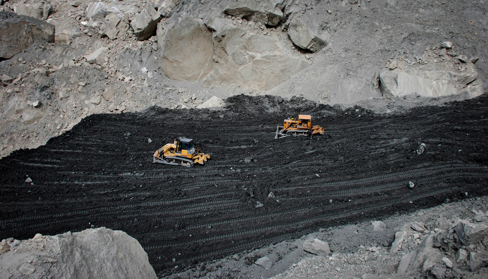
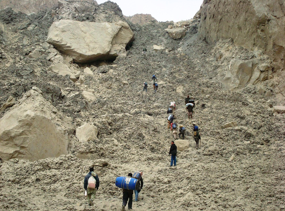
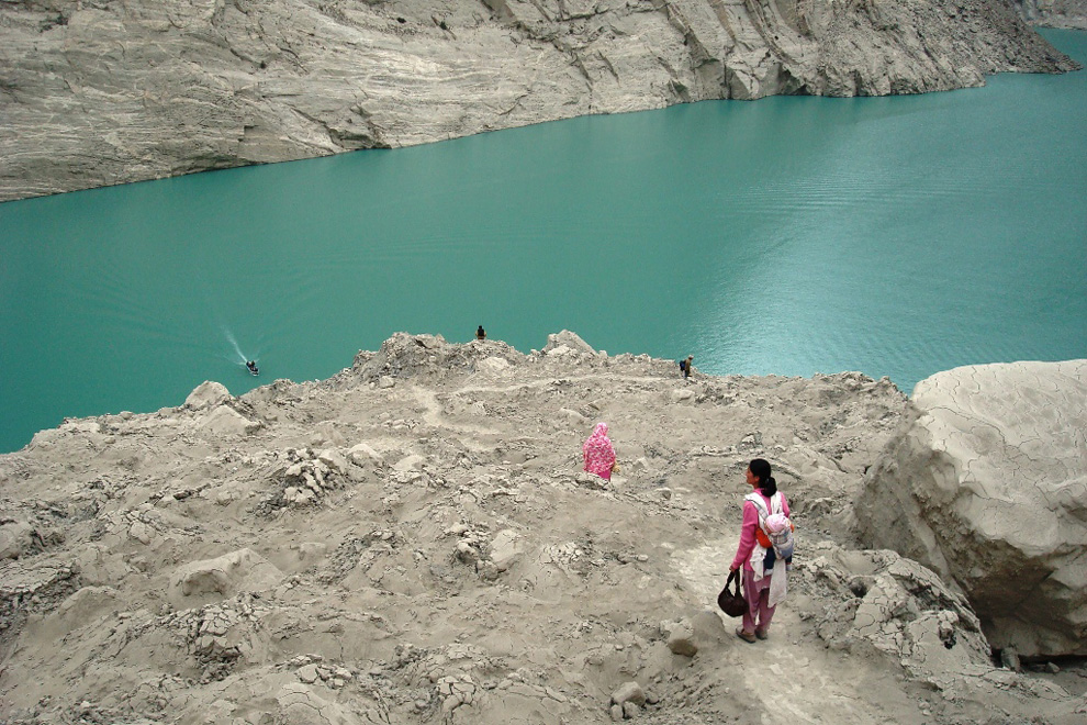
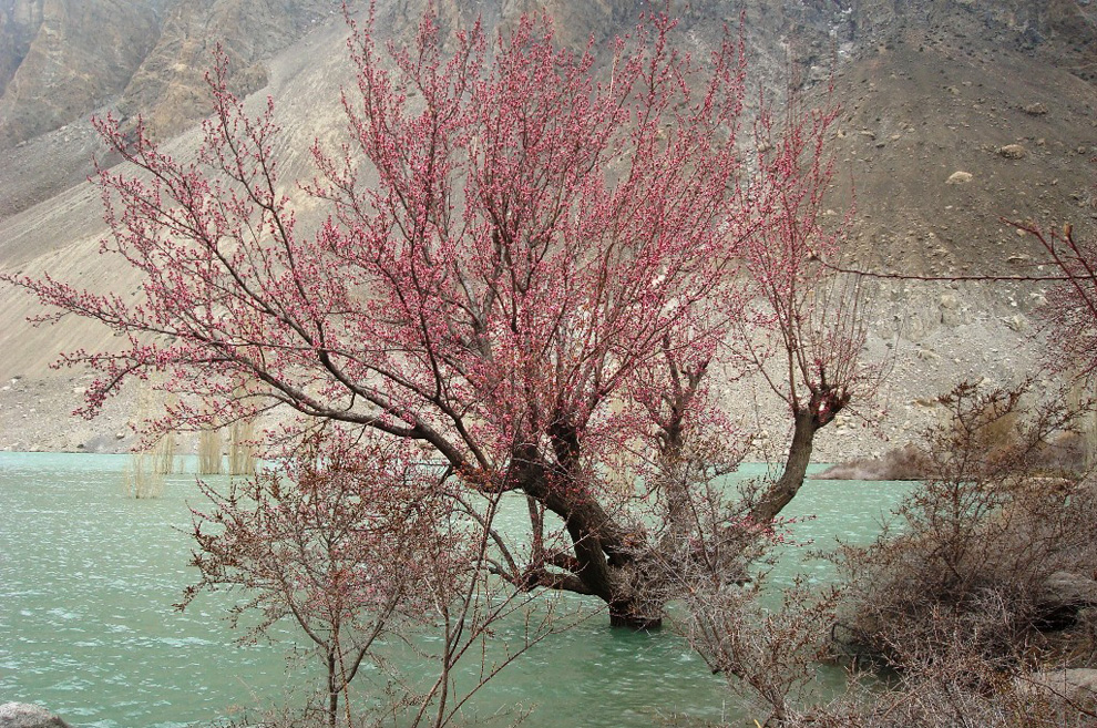
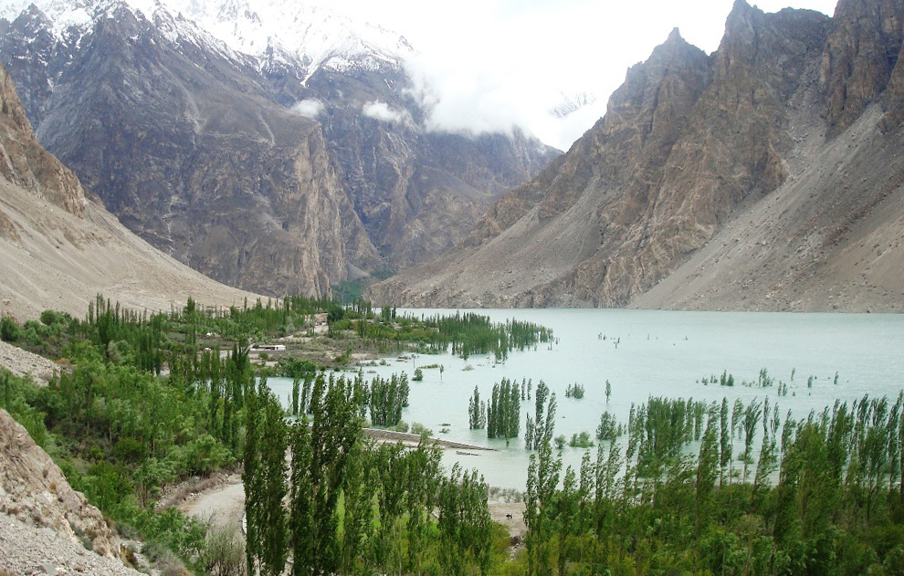
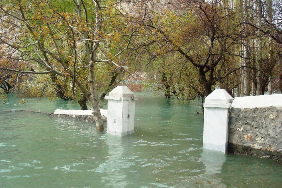
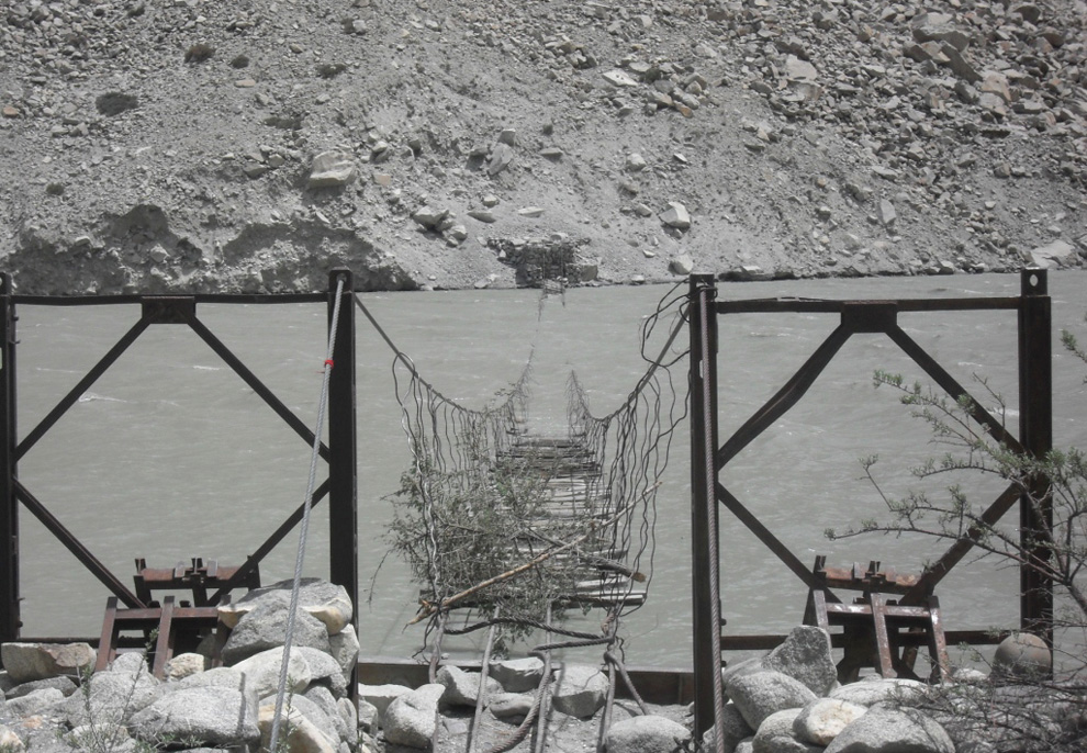
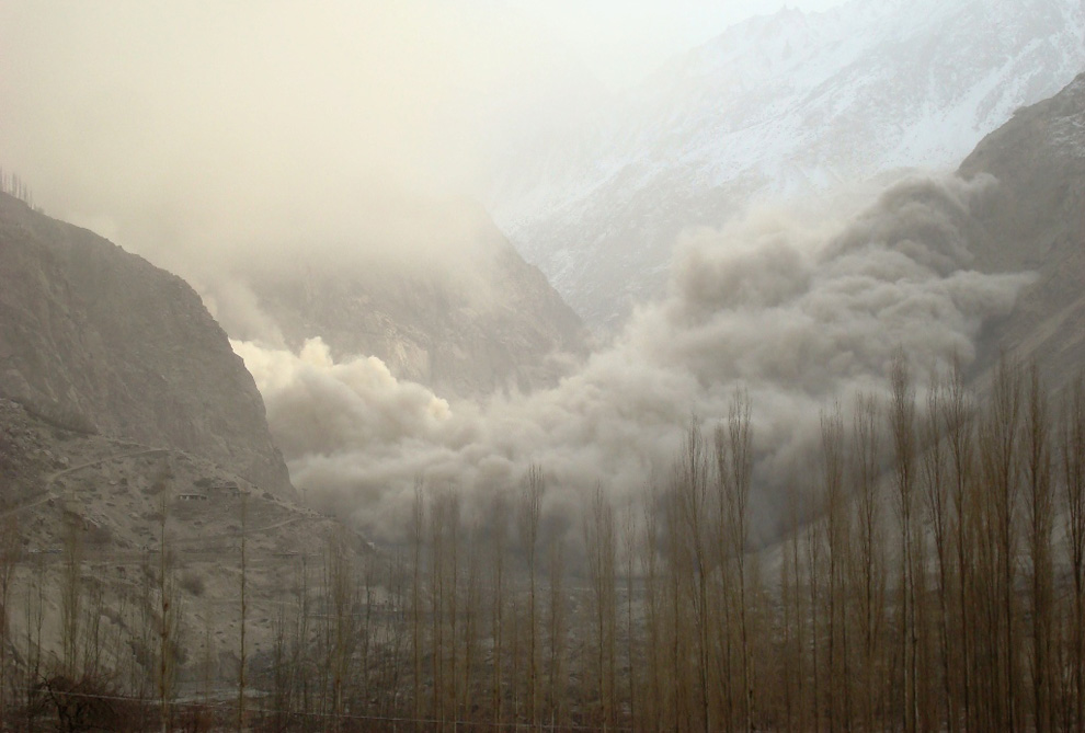
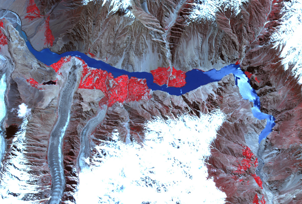
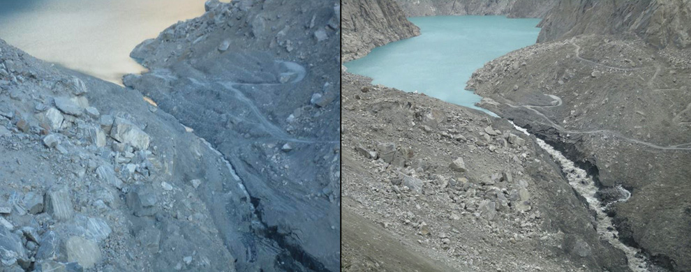
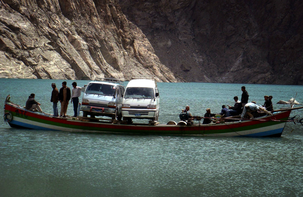
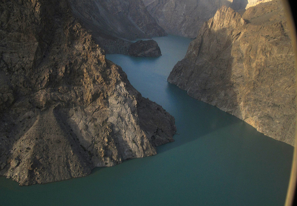
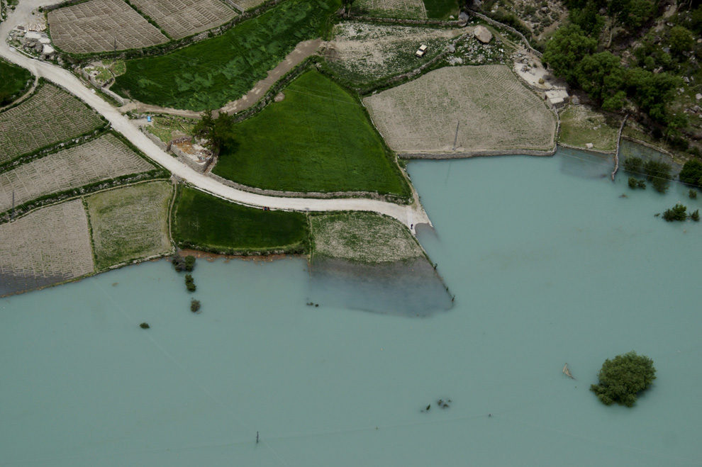
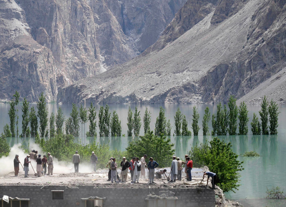
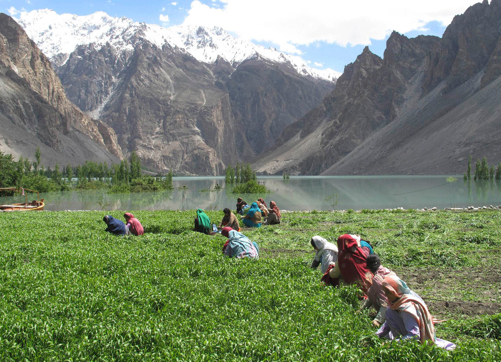
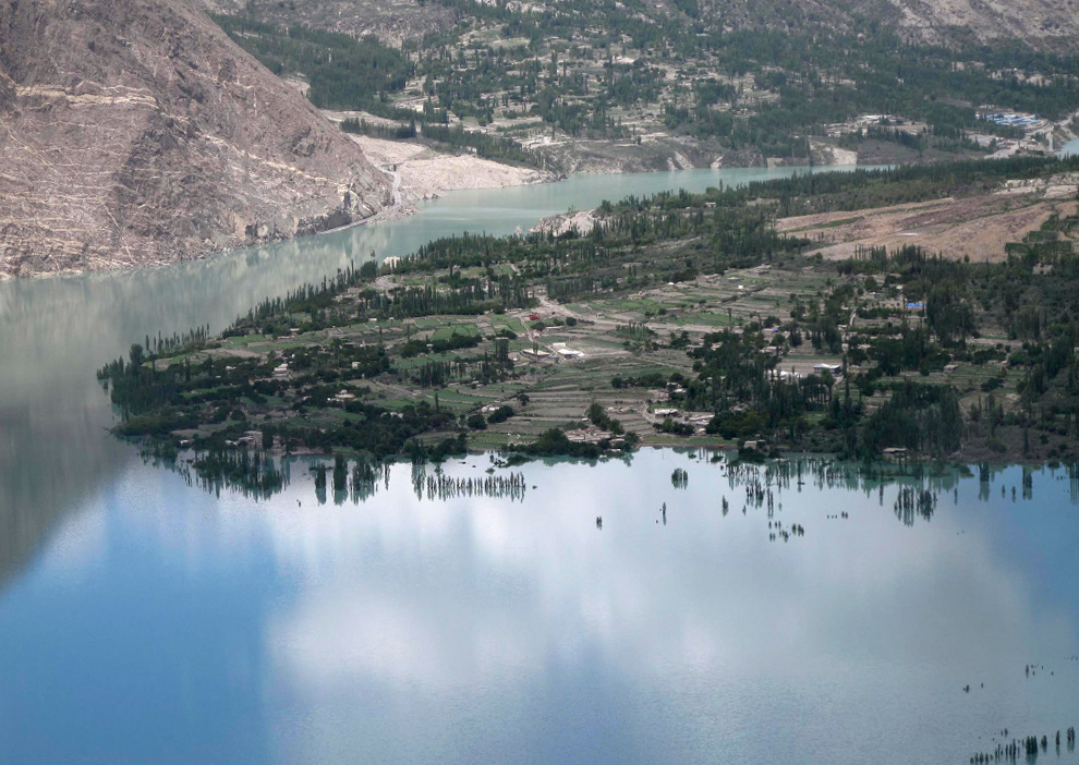
On January 4th, 2010 in the remote Hunza River Valley of northern Pakistan, a massive landslide buried the village of Attabad, destroying 26 homes, killing 20 people, and damming up the Hunza River. As the newly-formed lake grew, authorities rushed to evacuate and supply those affected in the landslide area and upstream. The lake is now over 300 feet deep and 16km (10 mi) long, submerging miles of highway, farms and homes. Earlier this week, the lake reached the top of the natural dam, and began to spill out - rapid erosion of the landslide debris has authorities worried about a potential breach, and locals have been evacuated as officials monitor the developing situation. Special thanks to the Pamir Times for sharing their photos and coverage of this event. (38 photos total)

This photograph was taken while a secondary landslide was taking place near Attabad village in northern Pakistan on January 22, 2010, after the original massive landslide of January 4th blocked most of the Hunza Valley and dammed the Hunza River. Original here. (Inayat Ali (Shimshal)/Pamir Times / CC BY-NC-ND)

Residents from surrounding area visit the scene of the massive landslide in the Hunza River Valley in northern Pakistan on January 5, 2010. Original here. (Zulfiqar Ali Khan/Pamir Times / CC BY-NC-ND) #

A view of the newly-forming lake formed due to blockage of the Hunza River, seen three days after the landslide, on January 7, 2010. Original here. (Zulfiqar Ali Khan/Pamir Times / CC BY-NC-ND) #

Land cracks visible in the land near what remains of the village of Attabad on February 1, 2010. FOCUS geologists warned that the cracked portions might fall at any time. Original here. (Zulfiqar Ali Khan/Pamir Times / CC BY-NC-ND) #

Another view of the growing lake formed behind the landslide, seen from the ruins of Attabad village on February 1, 2010. Original here. (Zulfiqar Ali Khan/Pamir Times / CC BY-NC-ND) #

Local volunteers conducting search for bodies in rubble near the village of Attabad on January 6, 2010. Original here. (Zulfiqar Ali Khan/Pamir Times / CC BY-NC-ND) #

A funeral service is held for some of the victims of the Hunza Valley landslide on January 6, 2010. Original here. (Zulfiqar Ali Khan/Pamir Times / CC BY-NC-ND) #

Men climb across landslide debris in the Hunza River Valley on January 7, 2010. The growing lake is visible in the background. Original here. (Zulfiqar Ali Khan/Pamir Times / CC BY-NC-ND) #

With the only highway wiped out by the landslide, Gojal Valley locals turn to airlifts to help them evacuate and get access to goods and services. Photo taken on January 7, 2010. Original here. (Zulfiqar Ali Khan/Pamir Times / CC BY-NC-ND) #

Heavy machinery is employed to lift and carry a wooden boat up the side of the landslide debris to be deposited in the lake to aid evacuation and supply missions on April 6, 2010. Original here. (Zulfiqar Ali Khan/Gulsher Khan/Pamir Times / CC BY-NC-ND) #

In this image taken on April 30, 2010, local people use a boat to ferry their vehicles in a lake caused by landslide which cuts off part of the Karakoram highway to China, in the Hunza district of northern Pakistan. (AP Photo/Shabbir Mir) #

In this image taken on Thursday March 11, 2010, Pakistani loaders carrying goods imported from neighboring China which are ferried through a lake due to blockade of the Karakoram Highway, in Attabad, northern Pakistan. A massive landslide early this year formed a natural dam in the Hunza River created a lake that is consuming upstream as it expands. If dam breaks, a flash flood could threaten downstream villages. (AP Photo/Shabbir Ahmed Mir) #

An aerial view, taken from military helicopter, of a natural dam caused by a landslide in Attabad village, Hunza district, northern Pakistan, May 21, 2010. Thousands have been evacuated from their homes this week in north Pakistan amid fears a lake, formed after a landslide blocked the Hunza River on January 4, could soon burst, triggering massive flooding and severing an important trade link with China. (REUTERS/Abrar Tanoli) #

An aerial view, taken from military helicopter, of a natural dam caused by a landslide in Attabad village, Hunza district, northern Pakistan, May 21, 2010. (REUTERS/Abrar Tanoli) #

An aerial view shows a lake overtaking a village in the Hunza district of northern Pakistan on Saturday, May 29, 2010. (AP Photo/Shabbir Hussain Imam) #

Villagers, who lived near a lake created after a landslide in Hunza district, collect belongings from their home at Sheeshghat village in Hunza district of northern Pakistan May 24, 2010. (REUTERS/Abrar Tanoli) #

Women, who lived near a lake created after a landslide in Hunza district, cut barley in a field in Seeshghat village in Hunza district of northern Pakistan May 24, 2010. (REUTERS/Abrar Tanoli) #

As water rises, locals use a makeshift pedestrian bridge to help them supply and evacuate in the Hunza River Valley in northern Pakistan. The pillars are from an under-construction "friendship bridge" for the now-partly-submerged Karakoram Highway. Photo taken on March 17th, 2010. Original here. (Pamir Times / CC BY-NC-ND) #

This image, acquired by the Advanced Land Imager (ALI) aboard NASA's Earth Observing-1 (EO-1) satellite on March 16th, 2010 shows the blocked Hunza River and the growing lake, then 11 km (7 mi) long, inundating several villages and 5 km (3 mi) of the Karakoram Highway. Landslide blockage is at lower right. (NASA Earth Observatory/Jesse Allen/NASA EO-1 team) #

Pillars of the under-construction "friendship bridge" for the Karakoram Highway, now flooded - seen on May 2nd, 2010, only two weeks after the same scene was photographed from a different angle in image #18. Original here. (Pamir Times / CC BY-NC-ND) #

While the boats brought to the new lake have been a great help for the stranded people, concerns for safety of the passengers remains a major issue. Photo taken on May 2nd, 2010. Original here. (Zulfiqar Ali Khan/Pamir Times / CC BY-NC-ND) #

Pakistani soldiers help villagers as they board an army helicopter in the village of Altitin in the Hunza district of northern Pakistan on May 21, 2010. Flooding from a lake in northern Pakistan risks affecting 40,000 residents of some 34 villages already evacuated to safety, a top disaster management official said. (STR/AFP/Getty Images) #

Children walk near tents set up for displaced people who were affected by a natural dam caused by a landslide in Attabad village in Hunza district of northern Pakistan May 19, 2010. (REUTERS/Abrar Tanoli) #

A girl cries while sitting with others to protest against the government's failure to announce compensation for those displaced by a lake created after a landslide during a demonstration in Attaabad village in Hunza district of northern Pakistan on May 22, 2010. (REUTERS/Abrar Tanoli) #

Residents of the Gojal (Upper Hunza) Valley ride across the lake flooding their villages and rising daily. Original here. (Zulfiqar Ali Khan/Pamir Times / CC BY-NC-ND) #

A view from a military helicopter of the lake growing behind a natural dam caused by a landslide which passes through Sheeshgat village in Hunza district of northern Pakistan May 24, 2010. (REUTERS/Abrar Tanoli) #

On February 28th, The second largest bridge on Karakuram Highway submerged in the lake water between Shishkat and Gulmit, two of the largest settlements of Gojal valley. The bridge had already been closed for all sorts of traffic due to the dangers posed by wind and water. Photo taken on February 22, 2010.Original here. (Zulfiqar Ali Khan/Pamir Times / CC BY-NC-ND) #

Workers use machines to dig a spillway to release water pressure built up by the natural dam caused by a landslide in Attabad village in Hunza district of northern Pakistan May 12, 2010. Fears are growing a lake created by a landslide will burst and cause a massive flood that could affect more than 50,000 people in northern Pakistan and disrupt a key trade link with China, residents said on Wednesday. (REUTERS/Moizuddin) #

In this mage taken on Thursday March 11, 2010, bulldozers leveling a ground to make spill for water accumulated in a lake due to blockade the Hunza River in Attabad, northern Pakistan. A massive landslide early this year formed a natural dam in the Hunza river created a lake that is consuming upstream as it expands. If dam breaks, a flash flood could threaten downstream villages. (AP Photo/Shabbir Ahmed Mir) #

The people of Gojal carrying daily essentials on their backs across the landslide site on January 12, 2010. Original here. (Zulfiqar Ali Khan/Pamir Times / CC BY-NC-ND) #

People climb the 700 ft high landslide debris to be able to reach the boats while moving towards Gojal Valley on March 28, 2010. Original here. (Zulfiqar Ali Khan/Pamir Times / CC BY-NC-ND) #

Some trees will bloom only for a while this year in the Gojal Valley villages of Ayeenabad and Shishkat in northern Pakistan. Photo taken on March 28, 2010.Original here. (Zulfiqar Ali Khan/Pamir Times / CC BY-NC-ND) #

A scene looking down on flooded orchards and homes in the village of Ayeenabad, Pakistan on May 8th, 2010. The hard work of at least three generations have been destroyed by the lake. Original here. (Zulfiqar Ali Khan/Pamir Times / CC BY-NC-ND) #

A gate near an orchard lies submerged in the upper Hunza Valley on April 14th, 2010. Around 40 houses in Ayeenabad and Shishkat Payeen have been dismantled to save valuables from sinking in the lake water. Original here. (Zulfiqar Ali Khan/Pamir Times / CC BY-NC-ND) #

A partially submerged pedestrian bridge in the Upper Hunza Valley, seen on May 7th, 2010. Original here. (Afzal Khan and Aslam Shah/Pamir Times / CC BY-NC-ND) #

Huge clouds of dust arise as land slides continued on January 6, 2010, the second day of the Attabad disaster. Original here. (Afzal Khan and Aslam Shah/Pamir Times / CC BY-NC-ND) #

The Advanced Spaceborne Thermal Emission and Reflection Radiometer (ASTER) on the Terra satellite acquired this false-color image of the landslide lake on June 1, 2010 - now 16km (10 mi) long. Compare to image image #19 above, taken 10 weeks earlier, and see that the lake has grown by 5km in length. Water appears in varying shades of blue. Vegetation is red. Bare rock appears in shades of brown and gray. (NASA Earth Observatory/Jesse Allen/GSFC/METI/ERSDAC/JAROS, and U.S./Japan ASTER Science Team) #

After the lake began to flow through the spillway that was cut into the landslide debris on May 29th, the flow of the water has increased, but still does not match the inflow upstream from the Hunza River. And - as is evidenced by these two images (May 30th on the left, June 4th on the right), the outflow is eroding the debris, working back toward the lake - potentially signaling an upcoming breach where nearly five months worth of river flow might wash away the dam and cause serious flooding downstream. Scientists and authorities are monitoring the situation and evacuations have been undertaken for all threatened areas. (Images courtesy of Focus Humanitarian Assistance via Professor David Petley / Hunza Landslide monitor

Full of Entertainment

~!~Full of Entertainment!~!~

search

feedcount