Thursday, October 29, 2009

Gasherbrum2

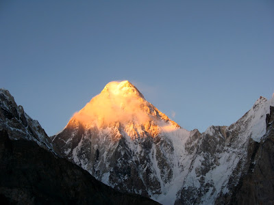
Gasherbrum II (also known as K4) is the 13th highest mountain on Earth, located on the border of Pakistan-China. Gasherbrum II is the third highest peak of the Gasherbrum massif, located in the Karakoram range of the Himalaya.

The standard route is via the SW ridge as it is relatively free of objective hazards such as ice falls and avalanches. A typical expedition lasts 7 to 8 weeks with climbing permits costing about $7,500 USD for five climbers.

Gasherbrum II was first climbed on July 81956by Fritz Moravec, Josef Larch and Hans Willenpart of an Austrian expedition.


Dudiptsar Lake


Dudiptsar lake or Dudipat Lake

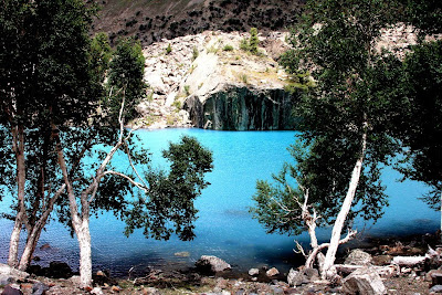
is a beautiful lakeencircled by snow clad peaks. The lake lies in the extreme north of Kaghan Valley at N35.0185 E74.0895 and is about a four hours drive from the chief town Naran. The road is not entirely accessible for cars, even Jeeps. From Besalonwards the visitors have to trek about 6-8 hours in vast alpine meadows to reach the lake.First four hour trek is really hard.And best season for visit is after 25th july till end of september.

Trek consists of at sometimes steep climb while at other places walk through huge flat valleys, but at all the time filled with amazing sights.

Its water is a beautiful greenish blue and very cold too. Dudipatsar is also close to another major Lake Lulusarwhich is the main contributory to the Kunhar river that runs through Kaghan valley. At a distance from the lake lies theBabusar Top or the Babusar Pass which is the end of 150 km long Kaghan valley.

The whole area is accessible for four months every year from June-September after which it is closed to snow.

It is highly not advised to track it in snow, as there is a high probability of avalanches in the area. The lake used to have abundance of trout, but illegal fishing using dynamite and nets has resulted in a sharp decline.

The word "dudi" means white and "sar" means lake. This name has been given to the lake because of the white color of snow at surrounding peaks. In summer the water of the lake reflects like a mirror. Getting to the lake takes four to six hours of tough hiking.

The word "sar" is used with the name of each lake in the area meaning lake. In the summer when the water of the lake reflects like a mirror a large number of visitors from different areas of the country come to watch the enchanting views of these lake.

The whole area is private property but declared national park by Government of Pakistan.

The deep blue Dudipat Sar, at 3,800 meters, is surrounded by green hills at about 4,800 meters, with snow patches in the shady hollows. This lake is very little visited by people and its natural beauty is still very much protected. October 8, 2005's earthquake in North Pakistan has made it more difficult to be accessed. However the government of Pakistan decided on March 14, 2006 to take all steps to restore tourism of the Kaghan valley which includes building new tourism spots and rebuilding previously destroyed ones.


Tuesday, October 27, 2009

Naltar Lake


There is a lake in the Naltar valley known as 'Bashkiri Lake'at a distance of 32 kilometers from Naltar Bala.This lake is a wonderful and marvelous look in the summer and as well as winter.The road from village to "Lake" is nonmetallic and narrow along side of a stream throughout this road coming from the mountains.There are a lot of beautiful scenes along this road.In winter it is almost impossible to reach the lake through any vehicle due to the snow(10 to 15 feet high)on the road

.


Lake Saif ul Maluk


Lake Saiful Muluk (Urdu: سیف الملوک) is a lake located at the northern end of the Kaghan Valley (34°52′37.34″N 73°41′37.71″E / 34.8770389°N 73.6938083°E / 34.8770389; 73.6938083) near Naran. It is in the north east of Mansehra District in the North-West Frontier Province, Pakistan. At an altitude of 3,224 m (10,578 feet) above sea level it is amongst one of the highest lakes in Pakistan.

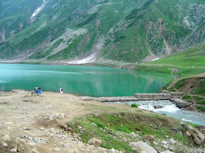
The lake is accessible by a 14 km road from Naran (which is accessible by a road from Mansehra via Balakot and Kaghan) during the summer months. On foot, the trek from Naran to the lake takes about 4-6 hours. The water is clear with a slight green tone. The clarity of the water comes from the multiple glaciers all around the high basin which feed the lake.

A fairy tale called Saiful Muluk, written by the famous sufi poet Mian Muhammad Bakhsh, is associated with the lake.[1] It is the story of prince of Persia who fell in love with a fairy princess at the lake.[2] The impact of the lake beauty is of such extent that people believe that fairies come down to lake in full moon.

A poet and writer from Balakot, Ahmad Hussain Mujahid, has written the story of Saif ul Malook. The first edition of the book Saif ul Malook was published in 1999.


Tourism

The Guardian ranked Lake Saiful Muluk as the 5th Best Tourist Destination in Pakistan. Mansehra District has had a flourishing tourism industry in the past due to its many mountain ranges and the Saiful Muluk Lake, however since the 2005 earthquake the region has seen a decrease in tourists. This lake is about ten thousand feet above the ground level of Naran, this beautiful lake reflects many colors in minutes.Lately there has been an interest in building hotels in the area.


Saturday, October 17, 2009

K2 ---> Second largest peak Pakistan

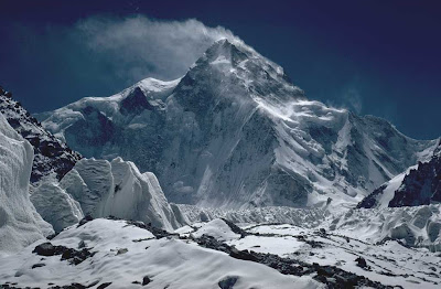
K2 is the second-highest mountain on Earth (after Mount Everest). With a peak elevation of 8,611 metres (28,251 ft), K2 is part of the Karakoram range, and is located on the border between the Taxkorgan Tajik Autonomous County of Xinjiang, China and Gilgit, in Gilgit-Baltistan of Pakistan. K2 is known as the Savage Mountain due to the difficulty of ascent and the 2nd highest fatality rate among the 'eight thousanders' for those who climb it. For every four people who have reached the summit, one has died trying. Unlike Annapurna, the mountain with highest fatality rate, K2 has never been climbed in winter.

The name K2 is derived from the notation used by the Great Trigonometric Survey. Thomas Montgomerie made the first survey of the Karakoram from Mount Haramukh, some 130 miles (210 km) to the south, and sketched the two most prominent peaks, labelling them K1 and K2.
The policy of the Great Trigonometric Survey was to use local names for mountains wherever possible and K1 was found to be known locally as Masherbrum. K2, however, appeared not to have acquired a local name, possibly due to its remoteness. The mountain is not visible from Askole, the last village to the south, or from the nearest habitation to the north, and is only fleetingly glimpsed from the end of the Baltoro Glacier, beyond which few local people would have ventured. The name Chogori, derived from two Balti words, chhogo ('big') and ri ('mountain') (شاہگوری) has been suggested as a local name, but evidence for its widespread use is scant. It may have been a compound name invented by Western explorers or simply a bemused reply to the question "What's that called?"[6] It does, however, form the basis for the name Qogir (simplified Chinese: 乔戈里峰traditional Chinese: 喬戈里峰pinyin: Qiáogēlǐ Fēng) by which Chinese authorities officially refer to the peak. Other local names have been suggested including Lamba Pahar ("Tall Mountain" in Urdu) and Dapsang, but are not widely used.
Lacking a local name, the name Mount Godwin-Austen was suggested, in honour of Henry Godwin-Austen, an early explorer of the area, and while the name was rejected by the Royal Geographical Society it was used on several maps, and continues to be used occasionally.
The surveyor's mark, K2, therefore continues to be the name by which the mountain is commonly known. It is now also used in the Balti language, rendered as Kechu or Ketu(Urdu: کے ٹو). The Italian climber Fosco Maraini argued in his account of the ascent of Gasherbrum IV that while the name of K2 owes its origin to chance, its clipped, impersonal nature is highly appropriate for so remote and challenging a mountain. He concluded that it was...
"...just the bare bones of a name, all rock and ice and storm and abyss. It makes no attempt to sound human. It is atoms and stars. It has the nakedness of the world before the first man - or of the cindered planet after the last."


Climbing routes and difficulties

There are a number of routes on K2, of somewhat different character, but they all share some key difficulties. First, of course, is the extreme high altitude and resulting lack of oxygen: there is only one-third as much oxygen available to a climber on the summit of K2 as there is at sea level. Second is the propensity of the mountain to experience extreme storms of several days' duration, which have resulted in many of the deaths on the peak. Third is the steep, exposed, and committing nature of all routes on the mountain, which makes retreat more difficult, especially during a storm. Despite many tries there has been no successful ascent during the winter. All major climbing routes lie on the Pakistani side, which is also where the base camp is located.


Abruzzi Spur

The standard route of ascent, used far more than any other route, is the Abruzzi Spur, located on the Pakistani side, first attempted by Luigi Amedeo, Duke of the Abruzzi in 1909. This is the southeast ridge of the peak, rising above the Godwin Austen Glacier. The spur proper begins at an altitude of 5,400 m/18,000 ft), where Advanced Base Camp is usually placed. The route follows an alternating series of rock ribs, snow/ice fields, and some technical rock climbing on two famous features, "House's Chimney" and the "Black Pyramid." Above the Black Pyramid, dangerously exposed and difficult to navigate slopes lead to the easily visible "Shoulder," and thence to the summit. The last major obstacle is a narrow couloir known as the "Bottleneck," which places climbers dangerously close to a wall of seracs which form an ice cliff to the east of the summit. It was partly due to the collapse of one of these seracs around 2001 that no climbers summitted the peak in 2002 and 2003.

On August 1, 2008, a number of climbers went missing when a serac in the Bottleneck snapped and broke their ropes. Survivors were seen from a helicopter but rescue efforts were impeded by the high altitude. Eleven were never found, and presumed dead


Routes

  • Northeast Ridge (long and corniced; finishes on uppermost part of Abruzzi route), 1978.
  • West Ridge, 1981.
  • Southwest Pillar or "Magic Line", very technical, and second most demanding. First climbed in 1986 by the Polish-Slovak trio Piasecki-Wróż-Božik. Since then the Catalan Jordi Corominas was the only successful climber on this route, despite many other attempts.
  • South Face or "Polish Line" (extremely exposed and most dangerous). In 1986, Jerzy Kukuczka and Tadeusz Piotrowski summitted on this route. Reinhold Messner called it a suicidal route and no one has repeated their achievement. "The route is so avalanche-prone, that no one else has ever considered a new attempt."
  • Northwest Face, 1990.
  • Northwest Ridge (finishing on North Ridge). First ascent in 1991.
  • South-southeast spur or "Cesen route" (finishing on Abruzzi route. A possibly safer alternative to the Abruzzi Spur because of avoiding the first big obstacle on Abruzzi called Black Pyramid ), 1994.
  • West Face (technically difficult at high altitude), done by a Russian team in 2007


Full of Entertainment

~!~Full of Entertainment!~!~

search

feedcount